Let’s start traveling through time!
Our Approach
For centuries humanity dreamed about time travel. While for now this remains a fantasy, in the meantime we have built a significant body of knowledge about the evolution of our habits, organisation of life, ways of controlling the environment, and finally developing our settlements to accommodate demands of growing populations. The recent technological advancement makes real what 20-30 years ago we could only imagine in sci-fi productions. This significant shift is interlinked with the continuous development of educational resources, which capitalises on new technologies and brings more depth in return.
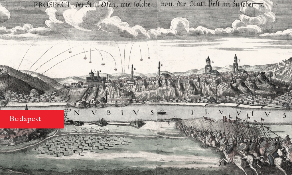
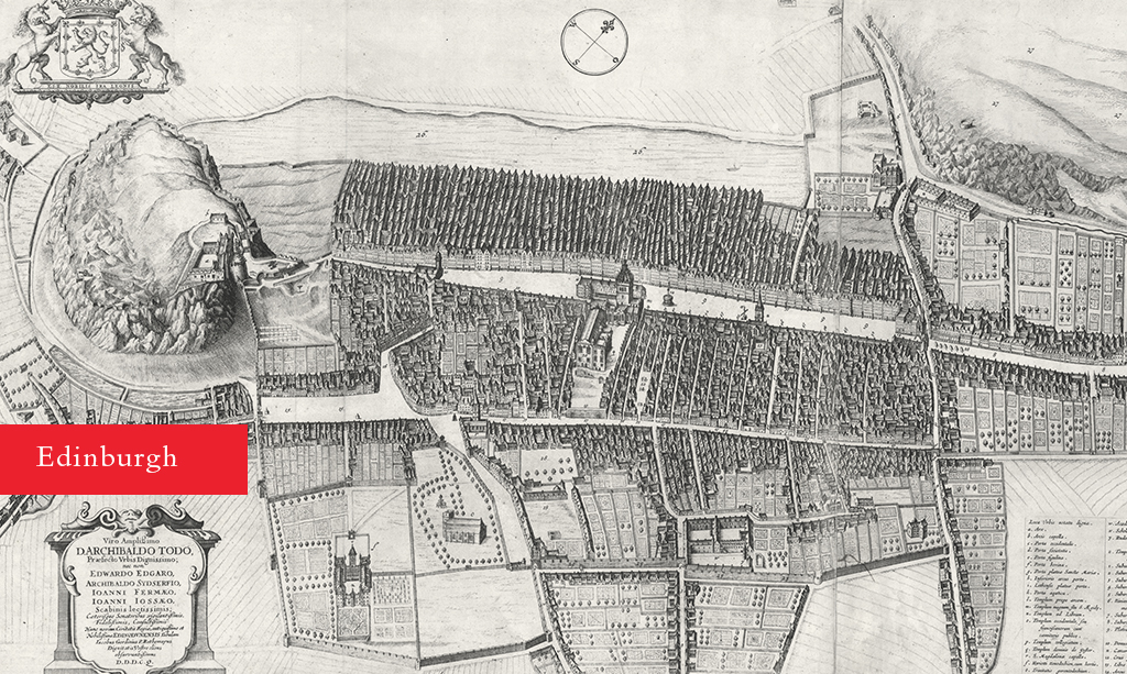
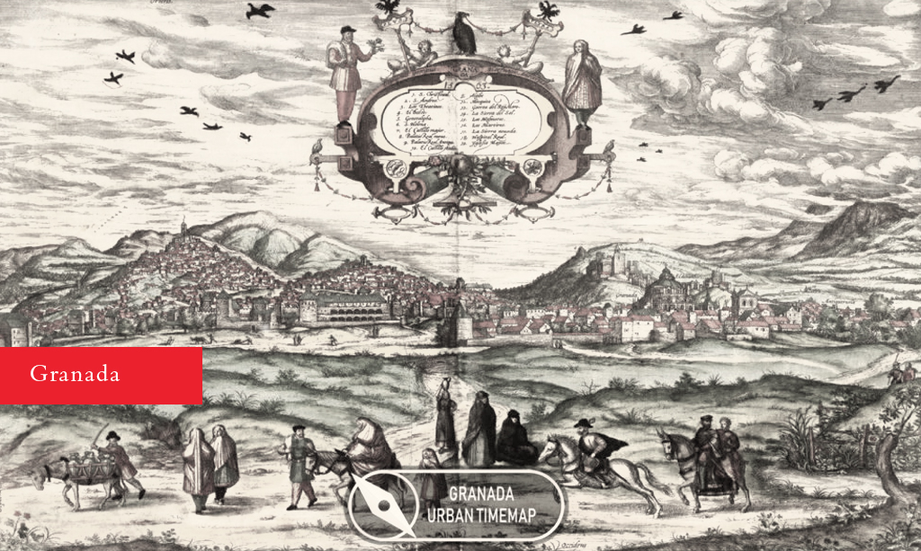
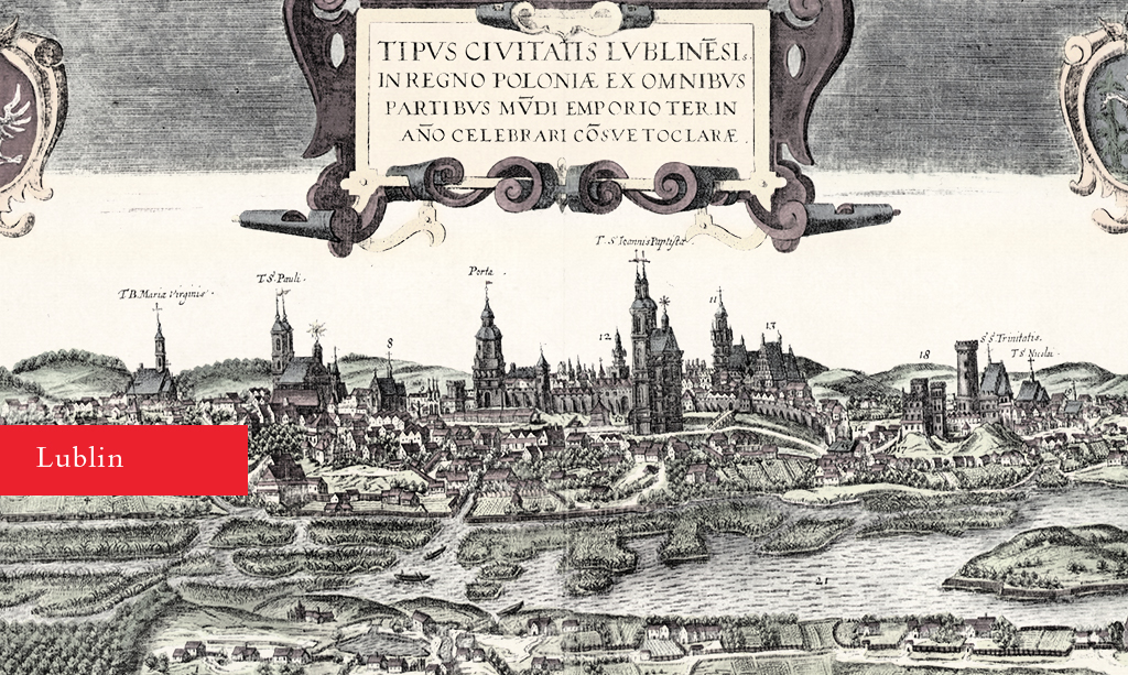
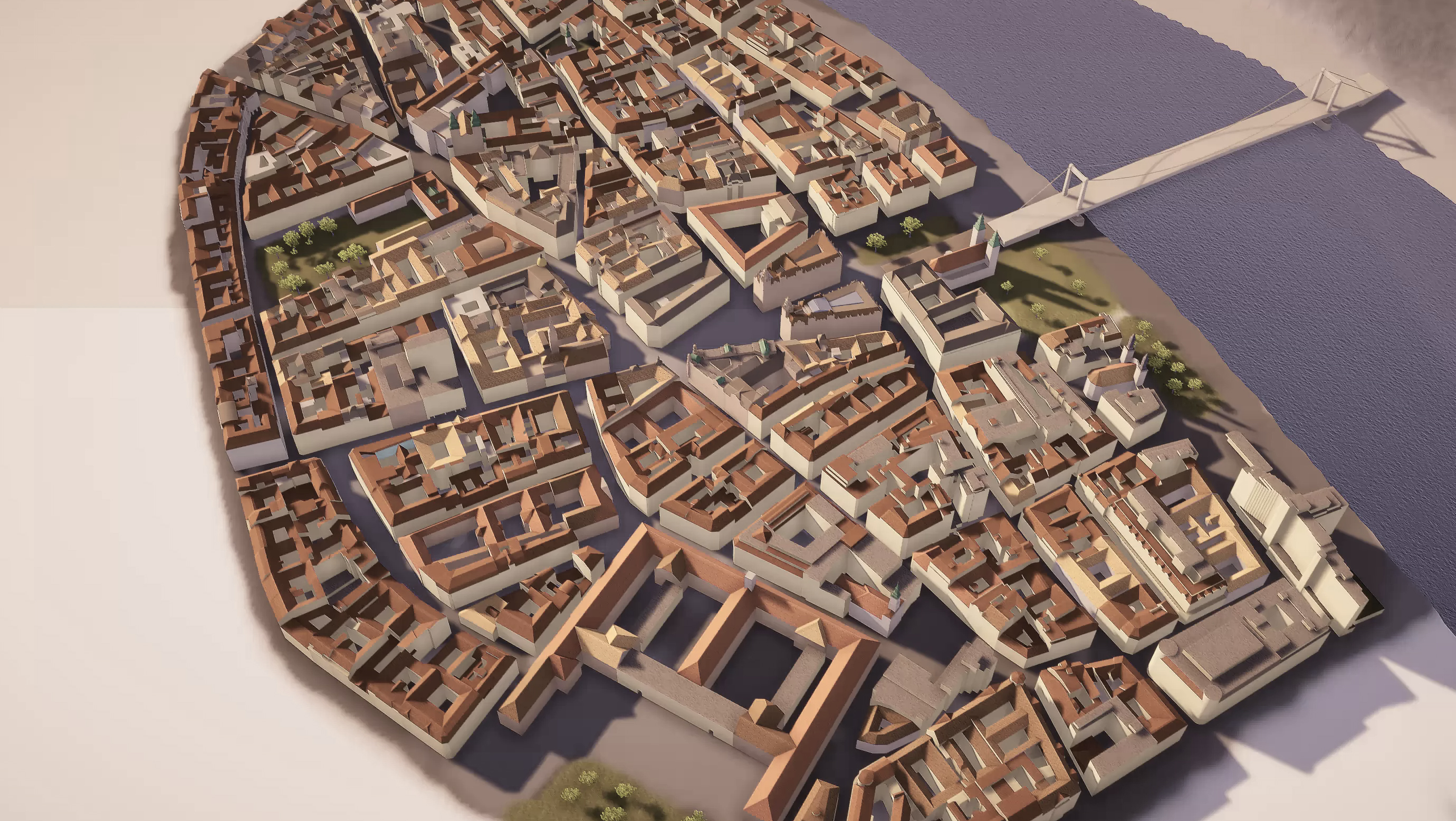
The APPROACH project responds to these issues in an imaginative and constructive way by visualising the spatial and architectural evolution of four historic European city-centres: Budapest, Edinburgh, Granada and Lublin. These evolutionary changes are embodied in a series of 3D “time maps” – a term specifically developed for the project to encompass cartography, planning, history, architecture, and 3D modelling. Moreover, each “time map” marks significant periods of social and political changes, which drove architectural and spatial changes. Our aspiration is to provide APPROACH users with a unique experience involving time travel, exploration, and learning, as well as an opportunity to compare how and where each city evolved in different historic phases. We are proud that the APPROACH online platform is a free of charge, intuitive, and accessible.
The development of the “time maps” was managed by a comprehensive methodology that involved historic research, transformation of raw data to 3D models, ongoing verification of outputs, and the compilation of a learning narrative. The project was delivered by four groups: researchers, modellers, project managers/coordinators, and students. Each modelled city (namely Budapest, Edinburgh, Granada and Lublin) had its research team collecting historic information, turning them into visual templates that would then be passed onto modelling teams based in Budapest and Cluj. In the next stage the modellers created 3D “white models”; their accuracy was verified by the researchers before the entire model received textures and was turned into the “interactive content”, which involved a fair amount IT engineering.
A vast amount of historic information was collected throughout the process. The research teams used a wide range of sources including: maps, drawings, paintings, photos, and texts. The process, in its nature rather than scale, could be compared to thereconstruction of Warsaw’s Old Town after the Second World War. “Info-boxes” provide narrative to the models, containing the most relevant learning information. They redirect to external sources for those seeking more detail;. Some of the most interesting research discoveries can be found in this comprehensive study, which binds together all outputs of the project.
Following a series of public meetings in all partner cities we have confidence in the educational value of the project’s outputs and their future potential for development. It is important to stress that the project involved design students from the Riga School of Art who actively participated in the project delivery and engaged with professional modellers and researchers. The educational aspect of the project is also represented by a series of online modelling tutorials, which can be found on our beautiful website. To understand the full value and potential of the APPROACH project we would encourage looking into all outputs of the project: the interactive content (“time maps”), the study, the tutorials, and the website.
The project was a great learning exercise for our partnership. This unique experience has underlined our confidence in the choices we made along the ups and downs of the project. What you see now is not the final product; our aspiration is to develop the APPROACH project further in the future.
Lear how to create your own urban time maps
The voice of Approach project’s protagonists during Cluj meeting
Project partners
Studies
Read the documentation of the project to discover more about how we created the urban time maps.